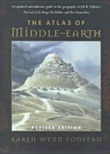
The Atlas of Middle-earth (ISBN 0-395-53516-6), written by the late Karen Wynn Fonstad, is an atlas of Middle-earth and the world of Arda. It has no affiliation with visual guides to Peter Jackson's Movie Trilogy, and is only centered on Tolkien's making of his world.
Description
The Atlas of Middle-earth is a superior cartographic reference book for Tolkien's writings, i.e. The Silmarillion, The Hobbit, and The Lord of the Rings, and includes many detailed maps of the lands described in them.
The maps are treated as if they are of real landscapes, drawn according to the rules of a real atlas for each area the history of the land is taken into account, as well as geography on a larger scale and from there maps are drawn. Discussion includes suggestions as to the geology that could explain various formations, and points that are contradictory between multiple accounts.
City maps and floor plans for important buildings are also included. The book was published in 1981, and in 1991, a revised and updated version was published, which took information from The History of Middle-earth series into account. It was, however, published before the final three volumes of The History of Middle-earth were published, and thus some maps are based on Tolkien's early works, which were revised in later writings.
Inaccuracies
- Throughout the atlas, the Witch-king is incorrectly referred to as "Angmar", such as in the list of the belligerents and estimated forces of the Battle of the Pelennor Fields, found on page 151. That said, the use of the place-name "Angmar" as a synonym for the Witch-king does have historical precedent.
- The placement of the Dwarf-city of Belegost is inconsistent. Under the First Age, Fonstad places Belegost approximately 150 miles south of its sister-city of Nogrod (see page 13) in accordance with The Shaping of Middle-earth, where it would have been drowned by the formation of the Gulf of Lune following the War of Wrath. However, in the Second Age (on page 38), she has inexplicably moved Belegost an additional 150 miles south to the middle of the southern Blue Mountains.
- Eressëa is spelled "Erresëa".
- Alqualondë is spelled "Aqualondë".
Contents
- Acknowledgements, Foreword, and Introduction
- The First Age
- The Second Age
- The Third Age
- Regional Maps
- The Hobbit
- The Lord of the Rings
- Thematic Maps; maps showing landforms, climate, vegetation, vernaculars by region, and population.
- Appendix, Notes, Selected References, and two Indexes
Template:Space
